
Below is a list of historical information that has been pulled together from various sources. Enjoy reading about the history of the lake.
- Pieces of Eight About Woodland Lake
- Learnings From Some of the Older Residents of the Area
- South Ore Creek Background ( Woodland Lake is a part of the South Ore Creek watershed )
- Other Insightful Links
Pieces of Eight About Woodland Lake
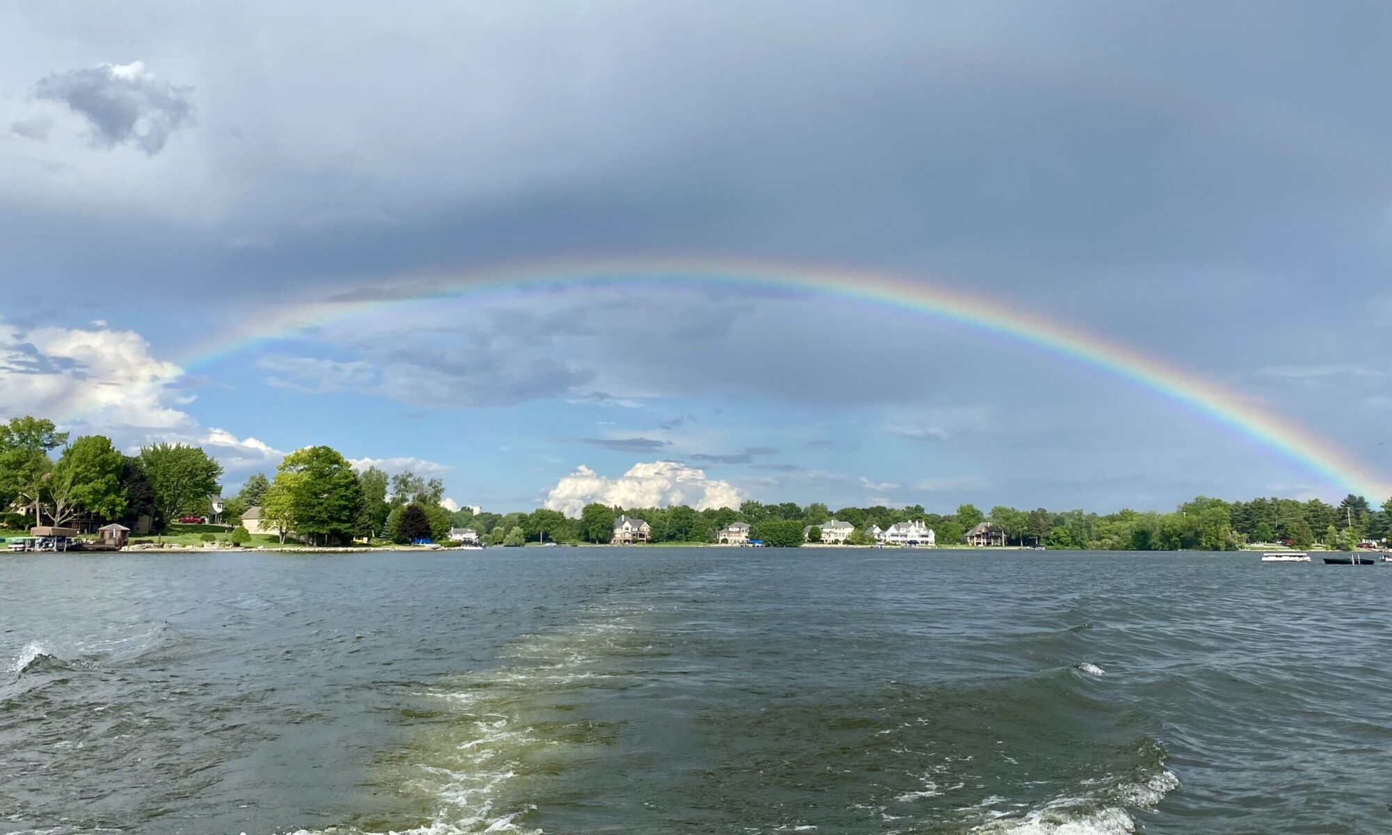
Many of us who live on the shores of Woodland Lake or have access to it, may be enjoying this beautiful lake with all its pleasures of fishing, boating, swimming, skiing and skating without ever giving a thought to its origin.
Here are some questions that may come to mind. How old is it? Is it man made? Who were the first settlers and from whom did they purchase the land? Are the stories about the lake, fact or fantasy?
Let us go back in time to learn a little of the factual history about the area.
In the year 1815, we find that Livingston County was part of Wayne County. In 1819, when Oakland County was formed, it included all the present Livingston County. In 1822, when Washtenaw and Shiawassee counties were laid out, the South half of now Livingston County was in Washtenaw and the North half in Shiawassee. Then, in March 1836, it was organized as Livingston County. It was named in honor of Edward Livingston, Secretary of State under President Andrew Jackson. Its center is at the center of a 90-mile circle, one outer radius extending to Detroit. Livingston County, at one time, was partly the domain of the Pottawattamies and Saginaw Chippewa Indians.
There was a time when Brighton was called Ore Creek. Grand River Ave., running along the west shore of Woodland Lake has been called many names: The Trail, The Plank road, The Gravel, The Pike and The Grade. (From – Text Franklin Ellis 12/1/1879 Abridged by Wm. A. Pless.)
The first man to make his home in Livingston County was Col. Soloman Peterson, who settled on Portage Lake in 1828. At this time, it was called Washtenaw County. The next settlers were Stephen Lee and Benjamin Curtis who settled in Green Oak Twp. In the fall of 1830. Hartland’s first settler was Col. Samuel Mapes from Niagara County. N.Y. 1831-32. Then followed Jesse Hall, Oct. 1831 in Hamburg; Elijah Marsh & Job Cranston in Brighton in the fall of 1832.
In the year 1833, cholera hit New York City. Many people sought homes elsewhere, among them artisans and gilders. One of them was entrusted with $800.00 with which to purchase land in Livingston County. In 1835 he came to Brighton Twp. And located many hundreds of acres of land for the people who had entrusted their money with him. Again, in 1836, he was entrusted with a similar mission, purchasing almost 20,000 acres of land. This land was purchased from the U.S. Govt. for a small fee, according to an act of Congress of Apr. 24, 1820. William S Conely came in 1837 and purchased 200 acres on section 7, 160 acres on section 18 ( sections 18 and 19 are current Woodland Lake). Elder Post, a Free-Will Baptist, came from Allegany Co., N.Y., and located also on section 18. He held religious services soon after his arrival, and is thought by one or two old residents to have been the first preacher in the township
Much of this land was bought on speculation, while upon a portion of it the owners settled some years later.
An example: – “U.S. Government to Abraham Pietch of New York City, N.Y. West half of S/E ¼ and E half of S/W ¼ of Sec. 18 in the twp. 2N Range 6E, containing 160 acres.
Martin Van Buren, President
Washington, D.C. Aug. 15, 1837
Recorded July 31, 1841 – 2 p.m.
Geo. W. Jewett, Reg of Deeds

Learnings From Some of the Older Residents of the Area
The white church on Hacker Road at Hyne was formerly the Benjamin Elementary School up to the 8th grade.
Originally, Woodland Lake was called Gay Lake before the dam was built.
At one time, the property just north of the bridge was owned by a farmer, Wallace Meyer. The original farmhouse still stands on Hacker Road. The Land was purchased by Woodland Lake Develop. Co., a Michigan Corp. – Geo. Almashy, Pres. & David Richards, Secretary. The old sheep barn on the premises was remodeled into “Pine Lodge”. It was a Mecca for parties, dancing and entertainment by some of the Detroit Companies. The lodge burned to the ground and was never rebuilt (Approx. Date about 1959-1960)
On Oct. 25, 1940, the State of Michigan purchased 3.5 acres of land off Hilton Road (Formerly called Dean Road) T2N R6E. The footage was approximately 1,050 ft. This was purchased from Robert Longthorne for $800.00 to make a public access. Pictures taken at that time show three buildings in the distance.
In 1952, a topography study was made of Woodland Lake by the Michigan Dept. of Waterways. The study makes it a reasonable assumption that originally there was a small Lake. Ore Creek (or South Ore Creek) rises on S/S of the watershed in Hartland, flows through Brighton Twp. Then joins the Huron River and finds its way by its channel to Lake Erie.
Around the early 1930’s, so the study goes, a dam was built which enlarged the lake and kept it at a constant level. A mapping of the lake and surrounding area in 1952, records the deepest depth to be 35 ft. just north of the access site. The maximum depth of the rest of the lake is 15-17 feet. The map shows the lake to be 290 acres. At this time, 1952, waterfront dwellings were developed to about 15%.
Plans for rebuilding this access have been decided by the DNR and the construction date was set for early spring of 1979.
Do you all agree that Woodland lake is a beautiful lake – actually a jewel? Let us all work together to keep it that way. Our enjoyment will be more pleasurable and property values will continue to rise. Who could ask for more?
Material for above obtained by researching Reg. of Deeds office. Also, from the Dept. of Waterways, Lansing.
Jane Follmer, a former OWL Trustee, researched information and wrote this article. (Retyped in full here March/2021)
South Ore Creek Background
(Woodland Lake is a part of the South Ore Creek Watershed)
Once covered by oak barrens, oak and hickory forests, and marshes and swamps, this creekshed was home to Chippewa and Potawatomi Native American tribes. Initial European settlement centered on the transformation of the open barrens for agricultural production and the forested areas for timber. Over the past few decades agriculture has been quickly diminishing as land has transferred to suburban uses.
This 34 square mile creekshed lies within Livingston County and comprises all or portions of Hartland, Oceola, Genoa, Brighton, and Hamburg townships and the City of Brighton. There are 34 lakes (open water >5 acres) and 34 ponds (open water < 5 acres) in the South Ore creekshed. The three biggest lakes are Woodland Lake (258 acres), Long Lake (178 acres), and Brighton Lake (163 acres).
South Ore Creek’s main stem and its tributaries total 36 miles of waterways. The main branch starts at the outflow of Maxfield and Long Lakes. From there, it flows southwest until it reaches Woodland Lake, then flows south through the City of Brighton, and downstream to the Brighton Lake impoundment within the southwestern portion of the City of Brighton. Downstream of Brighton Lake, the creek flows through Brighton State Lake Recreation Area, which greatly helps South Ore Creek’s water quality toward the mouth of the creek. After exiting Brighton State Rec Area, the creek empties into Ore Lake, which then drains into the main branch of the Huron River. Throughout its run, the main branch of the creek drops 108 feet and has an average gradient of about 6 feet per mile, which is flat when compared to other creeks in the Huron River Watershed (Fleming and Norton Creek are 13 feet per mile, for example).

Other Insightful Links
Brighton Township Section Maps
Livingston County Bicentennial Special Section Published (2021)
An 1880 Text History of Early History
Woodland Lake, Big Lake, Big Beauty
South Ore Creek Profile
The Creation Of Woodland Lake
In September of 2012, I had an opportunity to spend an afternoon at the Brighton Public Library searching for any clues that might give me an insight into the origination of Woodland Lake. The lake is a man-made lake, created by damming up Ore Creek. With the much-appreciated help of Mr. Mark Mullinax I was able to find articles from the Brighton Argus back in 1928. At that time, the Argus was a weekly newspaper published on Wednesdays. By searching through microfiche of the papers, I found several articles on the creation of the Woodland Golf and Country Club, which was located where the Trinity Health medical facility now stands, and included the new Woodland Lake.
The May 23, 1928 article entitled “Work Started on Dam to Make Another Lake for Brighton” stated:
“Situated just north of the city of Brighton on U. S. 16, one of the greatest trunk lines of the state is a tract of land, recently owned by various farmers residing in the district now the property of the Capital Land Company of Detroit. When the company began the development of what is known as the Benjamin farm last year, no one knew the extent of their plans and even when the Brighton Mill property passed into their hands early this spring, it was but a conjecture just what use was to be made of the same together with the attendant water rights.
Now with 1283 acres of land at their command it has been made known that a new artificial lake is in process of construction, the same to be situated on the east side of Grand River to the south of what is known as the Ernest Crippen farm. Here a natural basin favors the project and a canal and dam will utilize the water of Ore Creek to make a silvery lake which will delight the eyes of all who travel on this great thoroughfare.
Overlooking the proposed lake, on the west side of the dividing highway, lies what is known as the Woodland Shores Subdivision. …Four hundred acres will be subdivided here by T. Glen Phillips, each lot an ideal site for a modern home. …$2500 residence restrictions have been approved and all building plans must be submitted to the company who have in this way guarded against any possible marring the general effect.”
In a later Brighton Argus article dated October 10, 1928 the story continues:
“As to the lake itself which will be unique with its island, and peninsula it is expected that it will be filled by Christmas time and ready for all kinds of winter sports. The dam, the controlling power which governs the waters of the lake, is the last word in expert construction 10 tons of reinforced steel being used in the work, a twelve foot cement slab, six feet under and six feet above the water affording protection against the waters of the lake. Neither expense nor pains have been spared at this spillway, the plans having been perfected by an expert from Ann Arbor, who designs viaducts for Wayne County and has drawn on his vast fund of experience to make this part of the work perfect in every detail.
…if 100 houses are erected next year and without a doubt they will be, it will mean a petition to the Pere Marquette railroad company for rapid transit into Detroit. In this way those working in the city may commute while staying with their families in this little bit of heaven.”
And in the December 12, 1928 article entitled “Woodland Clubhouse Was Opened Saturday” the story continues as I have selected references to the lake:
“…Saturday December 8, was the date of this charming informal opening, the time when members of the club and their friends could gather in the spacious club rooms and see for themselves what has been done in the beautifying of the rooms as well as secure a glimpse of the surrounding woodlands, hills and lake.
‘Something of what has been done,’ is no idle phrase. Months of the most careful painstaking labor by skilled workmen has produced this marvel, this immense year around playground comprising 1280 acres so fortunate in its situation, so attractive with its wooded hills, bubbling spring, its crystal clear brook and shimmering lake….
Nor did the work end with its nine miles of lake frontage, its four beaches, each leading approximately 100 feet to the clear cool waters, each attractive, balancing the other in beauty and natural grace.
It was no amateur who drew the plans of the dam which controls the water of the lake, delightful for boating in the summer and ice sports of all kinds during the winter months.”
I hope you enjoyed this little bit of history as I did.
Stan Lawrence